
Moovit launches urban mobility data, analytics tools to help cities
With access to this data and analysis, organisations can better manage their cities, from planning construction projects to managing current transport issues.

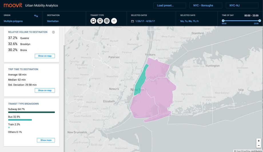
Moovit's urban mobility analytics for New York City.

Transport data company, Moovit, announced the availability of its data to cities worldwide in a new suite of tools that empower decision makers with accurate, real-time public transport data.
Moovit’s Smart Transit Suite includes a set of features that provide cities, organizations and governments access to an unprecedented amount of data available on public transport in cities worldwide. With access to this data and analysis, organisations can better manage their cities, from planning construction projects to managing current transport issues. Moovit is now able to provide a valuable data resource to communities that has until today been previously unavailable and will help to accurately shape the future of urban mobility. Other tools in the Suite include rapid, advanced survey capabilities and real-time bus locators.
Moovit built its tools after collecting hundreds of millions of data points every day for several years from more than 1,400 cities where Moovit is available. The company combined publicly available transport data from transit companies and government agencies with anonymous data from Moovit’s 60 million users and crowdsourced data from Moovit’s community of 170,000 local editors.

Moovit’s tools for cities include:
Moovit Urban Mobility Analytics — a powerful analytics tool that combines multiple data sources with advanced algorithms, analyses population movements around a city, and provides visual insights on public transport, all from anonymous aggregated data.
Transit Surveys — An advanced online system which creates, distributes and analyses transport related surveys answered by non-incentivised, targeted Moovit app users. These traveller surveys are managed in real time and provide results visualization as well as anonymised, detailed answers.
Transit Data Studio — A comprehensive transit data management tool with an easy-to-use web interface enables you to create, edit and manage public transit information. Based on the GTFS global standard, the data for transit stops, lines, shapes, trips, schedules, and more, can be accessed and used immediately by any external website or application.
Real time bus locator — A light, easily integrated cloud-based system that monitors, displays and analyses the real-time location of city buses. The Bus Locator also enables distribution of real-time bus arrival information to travellers via any website, mobile application or digital signs connected to Moovit’s API.
Trip Planner API — A web service accessed through an HTTP interface that allows public transit directions between locations with unprecedented multi-modal capabilities.
Moovit is available for free on iOS, Android & Web in over 1,400 cities, across 77 countries worldwide, and can be used in 43 languages.
More Technology
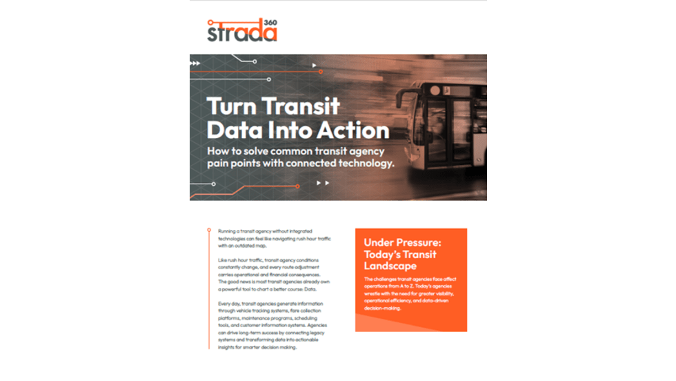
Turn Transit Data Into Action
Discover how leading agencies are using connected technology to gain real-time visibility across operations, improve service reliability, and reduce disruptions.
Read More →
Biz Briefs: OCTA Taps Clean Energy for Hydrogen Station, Stadler to Supply Via Rail Vehicles, and More
From manufacturers and suppliers to transit agencies and motorcoach operators, these updates offer a snapshot of the projects, partnerships and business moves driving the industry forward.
Read More →
CharterUP Expands Into New Mobility and Autonomous Transportation
Vice President of New Mobility Stephen Joos discusses how CharterUP is leveraging its nationwide transportation network, technology platform, and autonomous vehicle partnerships to expand into workforce mobility, campus shuttles, and transit solutions.
Read More →
METRO Magazine Announces 2026 Innovative Solutions Awards Winners
Projects Recognized for Advancing Mobility Through Technology, Accessibility, Workforce Innovation, and Operational Excellence
Read More →
Cummins Introduces Phased Model Year 2027 Launch Strategy
According to officials, the approach is designed to maintain regulatory compliance, support customer production schedules, and provide additional time to ramp production in a disciplined manner that helps ensure a successful transition for the industry.
Read More →Biz Briefs: STV teams with Amtrak, Motorcoach Operators Boost Fleet and Land Contracts, and More
From manufacturers and suppliers to transit agencies and motorcoach operators, these updates offer a snapshot of the projects, partnerships and business moves driving the industry forward.
Read More →
DART Taps Nathaniel P. Ford Sr. as Next President/CEO
Since 2012, Ford has served as the CEO of the Jacksonville Transportation Authority
Read More →
AC Transit’s Cecil Blandon on Building the Next Generation of Transit Maintenance Leaders
The agency’s maintenance chief discusses leadership, workforce development, zero-emission technology, and preparing technicians for the future of public transportation.
Read More →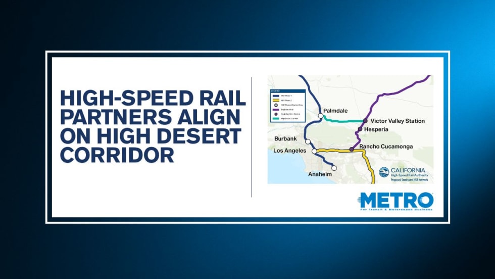
California High-Speed Rail Authority Signs MOU to Advance High Desert Corridor
The agreement deepens collaboration between the California High-Speed Rail Authority and the High Desert Corridor Joint Powers Agency, supporting design integration, cost savings, and faster delivery of a key Southern California rail link.
Read More →
Building the Next Generation of Transit Technology
In this edition of METROspectives, Luminator CEO Magnus Friberg discusses the company's transformation, the growing role of AI and software, and what's next for transit technology.
Read More →