
New PennDOT portal gives public access to transportation data
The data also offers an opportunity for application developers, students and others in private industry to analyze or pursue infrastructure issues and opportunities.

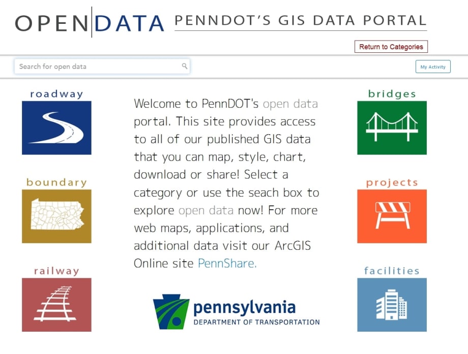
PennDOT Open Data portal screenshot.

Less than a month after Governor Tom Wolf announced steps to make Pennsylvania's data more transparent and accessible to the public, the Pennsylvania Department of Transportation (PennDOT) has launched an Open Data portal housing data ranging from roadway pavement conditions to rail facility locations.
The portal, http://data.pennshare.opendata.arcgis.com/, leverages a GIS platform used in several states and helps local government, planning and business partners as well as the public. The data, grouped by roadways, bridges, rail, facilities, boundaries and projects, can be used for mapping, sharing, charting and more.
"Transportation is vital to our way of life and the more people can use our data, the better our overall services will be for Pennsylvanians," PennDOT Secretary Leslie S. Richards said.
The data also offers an opportunity for application developers, students and others in private industry to analyze or pursue infrastructure issues and opportunities, Richards said.
The majority of the available data is updated daily, with some more static data such as boundaries, facilities and railway receiving periodic updates. The site is compatible with any device or platform.
"State agencies have a wealth of data that can be made open and available for others to use," said Secretary of Administration Sharon Minnich, whose office is leading the Governor's open data initiative. "The data sets being published by PennDOT and others will also become part of a centralized open data portal to make it easy for the public to find all the open data available from state government."
Data available for PennDOT's construction projects is also used through the department's projects website, www.projects.penndot.gov, which was launched last year to increase public information and transparency on active projects and those in the department's Four and Twelve Year Plans.
In addition, the public can request access to PennDOT's real-time, streaming video from its more than 700 traffic cameras as well as its Road Condition Reporting System Data, which provides real-time traffic incident, roadwork and other data. Information on these feeds is available at www.penndot.gov under "Doing Business" by selecting "Online Services" and "Developer Resources."
More Management
Turn Transit Data Into Action
Discover how leading agencies are using connected technology to gain real-time visibility across operations, improve service reliability, and reduce disruptions.
Read More →
What Transit-Oriented Development Means for the Future of Public Transportation
Once viewed primarily as transit operators, agencies are now leveraging land, partnerships, and long-term planning to boost ridership, expand housing, and strengthen communities.
Read More →
USDOT Announces $22 Million for Transit Innovation, Updates High-Speed Rail Rules
New federal transit funding will support safety, accessibility, and technology projects as updated rail regulations establish new noise standards for high-speed trains.
Read More →
Transportation Construction Coalition Unveils Infrastructure Case Studies Ahead of Federal Funding Deadline
The coalition noted the next surface transportation bill should provide sustained investment in highways and public transit to strengthen freight movement, improve safety, and support economic growth.
Read More →
People Movement: American Bus Association Extends Ferguson and More
METRO’s People Movement highlights the latest leadership changes, promotions, and personnel news across the public transit, motorcoach, and people mobility sectors.
Read More →
METRO Magazine Announces 2026 Innovative Solutions Awards Winners
Projects Recognized for Advancing Mobility Through Technology, Accessibility, Workforce Innovation, and Operational Excellence
Read More →
MBTA Rolls Out Pilot Programs to Cut Costs, Simplify Travel
Three new fare pilots — including unlimited two-hour transfers, reduced express bus fares, and free transit for eligible seniors — will launch this fall as Massachusetts extends popular commuter rail discounts through November.
Read More →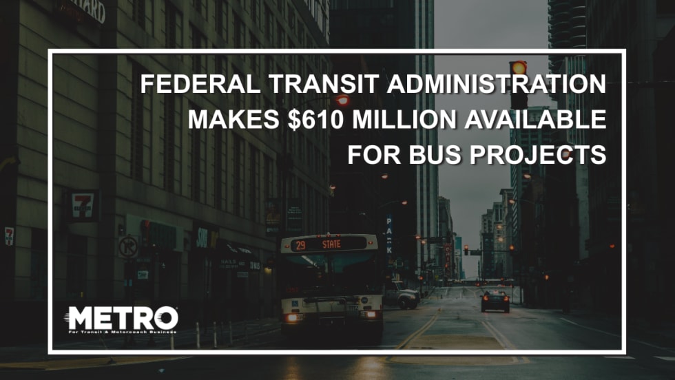
FTA Opens $610 Million Funding Opportunity for Bus Infrastructure Projects
The latest Notice of Funding Opportunity provides transit agencies with funding for bus facilities, fleet modernization, and low- and no-emission vehicles, with applications due September 21.
Read More →Biz Briefs: STV teams with Amtrak, Motorcoach Operators Boost Fleet and Land Contracts, and More
From manufacturers and suppliers to transit agencies and motorcoach operators, these updates offer a snapshot of the projects, partnerships and business moves driving the industry forward.
Read More →
Massachusetts Approves $530M to Strengthen MBTA Operations, Infrastructure
The funding package targets operating stability, capital improvements, and fare affordability, offering a model for agencies navigating long-term funding challenges.
Read More →