

Read More: Chicago Adopts Transit-Supportive Development Plan for Red Line Extension Project
MTI Study Provides How to Select Vertiport Site
The study is the result of a year-long regional geographic information system (GIS) case study of the San Francisco Bay Area analyzing vertiport site suitability across five counties.
June 7, 2023

Vertiports, areas that support electric vertical take-off and landing (eVTOL) aircraft, require more research in the emerging air sector known as Advanced Air Mobility (AAM).
Photo: Canva
2 min to read
The Mineta Transportation Institute (MTI) released new research, "Land Use Analysis on Vertiports Based on a Case Study of the San Francisco Bay Area," that aims to establish a framework for the systematic approach to vertiport site selection and provides recommendations for AAM best practices.
Vertiports, areas that support electric vertical take-off and landing (eVTOL) aircraft, require more research in the emerging air sector known as Advanced Air Mobility (AAM).
AAM is air transportation using eVTOL aircraft to move people and cargo between places not easily served by surface transportation or existing aviation modes.
More About the MTI Study
The approach established by this study ensures consistency in AAM land-use planning for a region while remaining flexible enough for regional differences like local zoning or state regulations.
The study is the result of a year-long regional geographic information system (GIS) case study of the San Francisco Bay Area analyzing vertiport site suitability across five counties (Alameda, Contra Costa, San Francisco, San Mateo, and Santa Clara Counties).
The study found that the number of suitable sites for vertiport placements increases with compact urban form and population density.
“The compact urban form of San Francisco contains higher population densities and, as a result, has a higher output of suitable parcels (1392). By comparison, San Jose in its suburban form contains only 43 resultant parcels that meet high priority standards,” explained the study’s authors.
MTI Recommends Key Policies
Key policy recommendations reveal that AAM land-use planning should:
Include participatory GIS in AAM stakeholder workshops and public meetings with 3D visualizations and auralizations to reduce fears about eVTOL aircraft noise and their aesthetics impacts.
Prioritize locations needing intermodality, such as hospitals and transit stations.
Value proximity to safe pedestrian and bicycle routes.
Understand that suitability varies by community and that preferences change.
Incorporate vertiports in Transit Oriented Development (TOD) plans and policies as a form of TOD infill and redevelopment.
Incorporate GIS site suitability AAM analysis into the Transportation and Land Use sections of comprehensive plans.
Add vertiport as a new land use category in land development codes and zoning ordinances.
More Management

Modernizing Mobility with CharterUP CEO Armir Harris
From digital transformation to evolving customer demands, CharterUP's Armir Harris offers his perspective on the transportation industry's next chapter.
Read More →
CTTC Enhances Transit Workforce Pipeline Through New Partnerships and Leadership
The group's latest initiatives focus on developing talent, expanding training opportunities and addressing workforce needs across the transit sector.
Read More →
San Diego MTS Keeps Service Intact With New FY 2027 Budget
The approved spending plan avoids route cuts and lays the groundwork for addressing transit funding challenges through the end of the decade.
Read More →
Solving The Driver Shortage: What Transit Agencies Can Learn From the Trucking Industry
See how transit agencies facing persistent driver shortages can learn from the trucking industry’s evolving strategies for recruitment, retention, workplace conditions, and more.
Read More →
FIFA World Cup Matches Are Driving Record Transit Ridership Nationwide
See how World Cup matches are generating record transit demand across North America, with ridership surpassing Super Bowls, concerts, and Olympic-era events.
Read More →
The Hidden Cost of Fuel Data Inaccuracy in Public Transit Fleets
In today's transit environment, accurate fuel and mileage data are critical to reducing costs, minimizing downtime, and improving fleet performance.
Read More →
Virginia's $28.5B Transportation Plan Targets Transit and Rail
Approved by the Commonwealth Transportation Board, the program supports ongoing infrastructure projects while providing new investments in transit, state of good repair and transportation alternatives.
Read More →
Latinos In Transit Seeks Host Organization for 2027 Leadership Summit
The selected host organization will showcase its transit system, projects, and community while welcoming hundreds of industry leaders and emerging professionals during Hispanic Heritage Month.
Read More →
Bipartisan BUSES Act Seeks Changes to New York City's Bus Idling Enforcement Program
Backed by motorcoach operators, the legislation seeks to balance emissions goals with passenger safety by allowing limited idling for inspections, accessibility needs and extreme weather conditions.
Read More →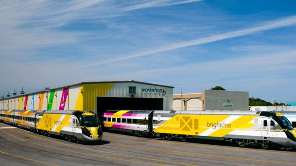
DOT: Brightline Corridor Incidents Fall 30% Following Federal Safety Upgrades
Safety improvements funded through a $25 million federal investment are credited with reducing trespassing and train-vehicle collisions along the Brightline Florida corridor.
Read More →