

RELATED: How Wayfinding Tech Delivers Transit Info to Customers
Are big-city transportation systems too complex for human minds?
the researchers found that navigating transport networks in major cities — including London, New York City, Toyko and Paris — can come perilously close to exceeding humans’ cognitive powers.
February 23, 2016
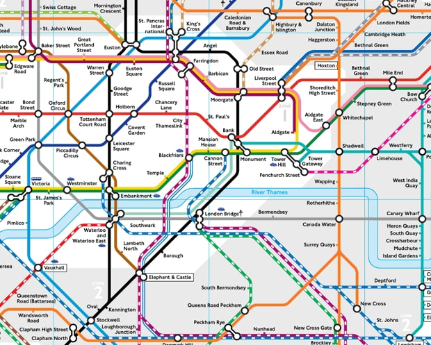
London Tube map. Transport for London
2 min to read

Many of us know the feeling of standing in front of a subway map in a strange city, baffled by the multi-coloured web staring back at us and seemingly unable to plot a route from point A to point B.
According to a new study published in the journal Science Advances, navigating routes through a complex urban transport system can often exceed the human brain's cognitive limits.
After analysing the world’s 15 largest metropolitan transport networks, the researchers at Oxford University estimated that the information limit for planning a trip is around 8 bits. (A ‘bit’ is a binary digit — the most basic unit of information.)
Additionally, similar to the "Dunbar number," which estimates a limit to the size of an individual’s friendship circle, this cognitive limit for transportation suggests that maps should not consist of more than 250 connection points to be easily readable.
Using journeys with exactly two connections as their basis (that is, visiting four stations in total), the researchers found that navigating transport networks in major cities — including London — can come perilously close to exceeding humans’ cognitive powers.
And when further interchanges or other modes of transport — such as buses or trams — are added to the mix, the complexity of networks can rise well above the 8-bit threshold. The researchers demonstrated this using the multimodal transportation networks from New York City, Tokyo, and Paris.
"Human cognitive capacity is limited, and cities and their transportation networks have grown to the point where they have reached a level of complexity that is beyond human processing capability to navigate around them," said Mason Porter, Professor of Nonlinear and Complex Systems in the Mathematical Institute at the University of Oxford. "In particular, the search for a simplest path becomes inefficient when multiple modes of transport are involved and when a transportation system has too many interconnections."
He adds that, in many cases, the maps currently in use need to be rethought and redesigned. Journey-planner apps of course help, but the maps themselves need to be redesigned.
The research – a collaboration between the University of Oxford, Institut de Physique Théorique at CEA-Saclay, and Centre d’Analyse et de Mathématique Sociales at EHESS Paris – is published in the journal Science Advances.
More Management
What Transit-Oriented Development Means for the Future of Public Transportation
Once viewed primarily as transit operators, agencies are now leveraging land, partnerships, and long-term planning to boost ridership, expand housing, and strengthen communities.
Read More →
USDOT Announces $22 Million for Transit Innovation, Updates High-Speed Rail Rules
New federal transit funding will support safety, accessibility, and technology projects as updated rail regulations establish new noise standards for high-speed trains.
Read More →
Transportation Construction Coalition Unveils Infrastructure Case Studies Ahead of Federal Funding Deadline
The coalition noted the next surface transportation bill should provide sustained investment in highways and public transit to strengthen freight movement, improve safety, and support economic growth.
Read More →
People Movement: American Bus Association Extends Ferguson and More
METRO’s People Movement highlights the latest leadership changes, promotions, and personnel news across the public transit, motorcoach, and people mobility sectors.
Read More →
METRO Magazine Announces 2026 Innovative Solutions Awards Winners
Projects Recognized for Advancing Mobility Through Technology, Accessibility, Workforce Innovation, and Operational Excellence
Read More →
MBTA Rolls Out Pilot Programs to Cut Costs, Simplify Travel
Three new fare pilots — including unlimited two-hour transfers, reduced express bus fares, and free transit for eligible seniors — will launch this fall as Massachusetts extends popular commuter rail discounts through November.
Read More →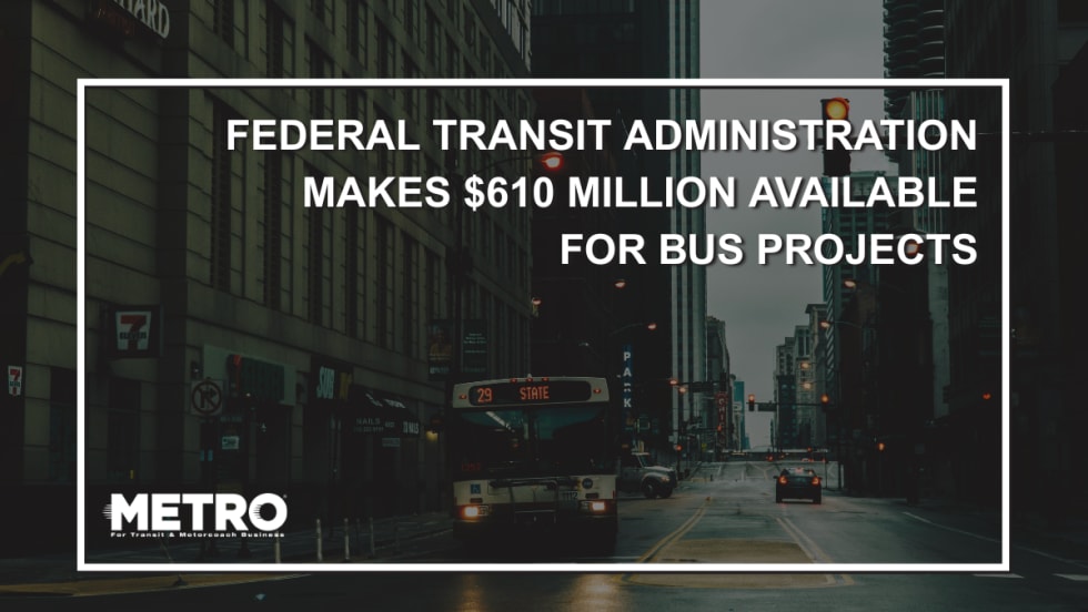
FTA Opens $610 Million Funding Opportunity for Bus Infrastructure Projects
The latest Notice of Funding Opportunity provides transit agencies with funding for bus facilities, fleet modernization, and low- and no-emission vehicles, with applications due September 21.
Read More →Biz Briefs: STV teams with Amtrak, Motorcoach Operators Boost Fleet and Land Contracts, and More
From manufacturers and suppliers to transit agencies and motorcoach operators, these updates offer a snapshot of the projects, partnerships and business moves driving the industry forward.
Read More →
Massachusetts Approves $530M to Strengthen MBTA Operations, Infrastructure
The funding package targets operating stability, capital improvements, and fare affordability, offering a model for agencies navigating long-term funding challenges.
Read More →
LA Metro Marks Banner Year, Sets Ambitious Goals for New Fiscal Year
Incoming LA Metro Board Chair and Los Angeles Mayor Karen Bass joined outgoing Board Chair Fernando Dutra and LA Metro CEO Stephanie Wiggins to review accomplishments from fiscal year 2026, which included the opening of new rail extensions, advancement of major transit projects, expanded safety programs, and new rider amenities.
Read More →