

RELATED: LIRR launches customer assistance for people with mobility issues
Long Island Railroad beta testing real-time train tracker tool
Customers can see real-time positions of all trains on phone, tablet or computer and view train lengths and locations of trouble spots.
February 6, 2019
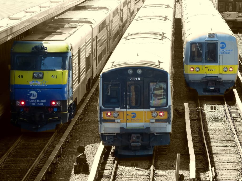
MTA Long Island Rail Road has launched a beta test of an online tool that allows customers to see the real-time position of trains on a map. Photo: MTA/LIRR Facebook
2 min to read

MTA Long Island Rail Road has launched a beta test of an online tool that allows customers to see the real-time position of trains on a map. It also shows information about train lengths and locations of any trouble spots affecting train service. The map is refreshed with new data every three to five seconds and benefits from the enhanced accuracy of GPS data.
To use the tool, customers can go to any web browser and navigate to mylirr.org. The first thing displayed is a list of LIRR stations with a customer’s selected favorite stations displayed at the top. Tapping on a station gives a list of upcoming trains, organized by scheduled arrival time for the eastbound and westbound directions. Tapping on any listed train pulls up a map that shows that train’s location within the LIRR systemwide map, which is overlaid on a geographically accurate map showing streets, parks, bodies of water, and more, all in a muted fashion that allows train service to be highlighted. As the train moves, the icon representing the train on the map moves as well.
To help customers be prepared if a train has fewer cars than normal, the tool also lists how long each train is. Zooming in on the train displays this information graphically, by showing an outline of the train, with each of the cars in the train appearing on the map.
Instances where ongoing track work is reducing the number of available tracks are shown on the map with a wrench icon, and unplanned events that can delay trains, such a switch or signal problem, broken rail, track condition or disabled train are shown with an exclamation point icon.
To enable the tool to function, the LIRR has installed GPS transponders on all trains, nearly 600 GPS units in total. The GPS data supplements information from the LIRR’s signal system to provide the tool with accurate real-time positions of trains. Areas in tunnels where GPS is unavailable use signal system data and station stops and intermediate waypoint beacons to identify train locations.
The tool supplements existing real-time offerings including email and text messages service alerts available at MyMTAAlerts.com, MYmta, and the LIRR Train Time app. The myLIRR tool is in beta, and the LIRR plans to amend and improve it based on customer feedback.
More Rail
Biz Briefs: STV teams with Amtrak, Motorcoach Operators Boost Fleet and Land Contracts, and More
From manufacturers and suppliers to transit agencies and motorcoach operators, these updates offer a snapshot of the projects, partnerships and business moves driving the industry forward.
Read More →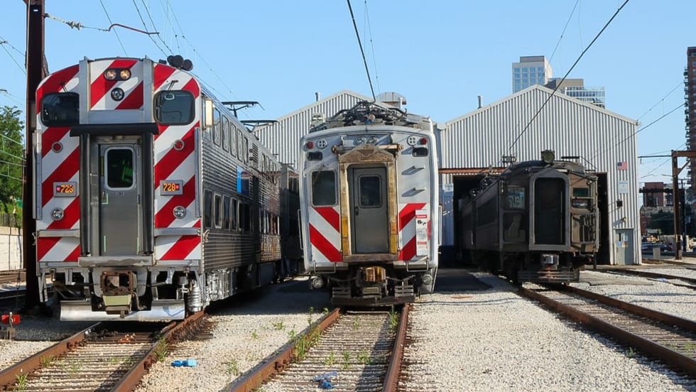
Metra Celebrates 100 Years of Electric Rail, Looks to the Future
The event was also a celebration of recent reforms to public transportation in the Chicago area, changes that could be as transformative in the future as the major civic achievement a century ago, said officials.
Read More →
LA Metro Marks Banner Year, Sets Ambitious Goals for New Fiscal Year
Incoming LA Metro Board Chair and Los Angeles Mayor Karen Bass joined outgoing Board Chair Fernando Dutra and LA Metro CEO Stephanie Wiggins to review accomplishments from fiscal year 2026, which included the opening of new rail extensions, advancement of major transit projects, expanded safety programs, and new rider amenities.
Read More →
DART Taps Nathaniel P. Ford Sr. as Next President/CEO
Since 2012, Ford has served as the CEO of the Jacksonville Transportation Authority
Read More →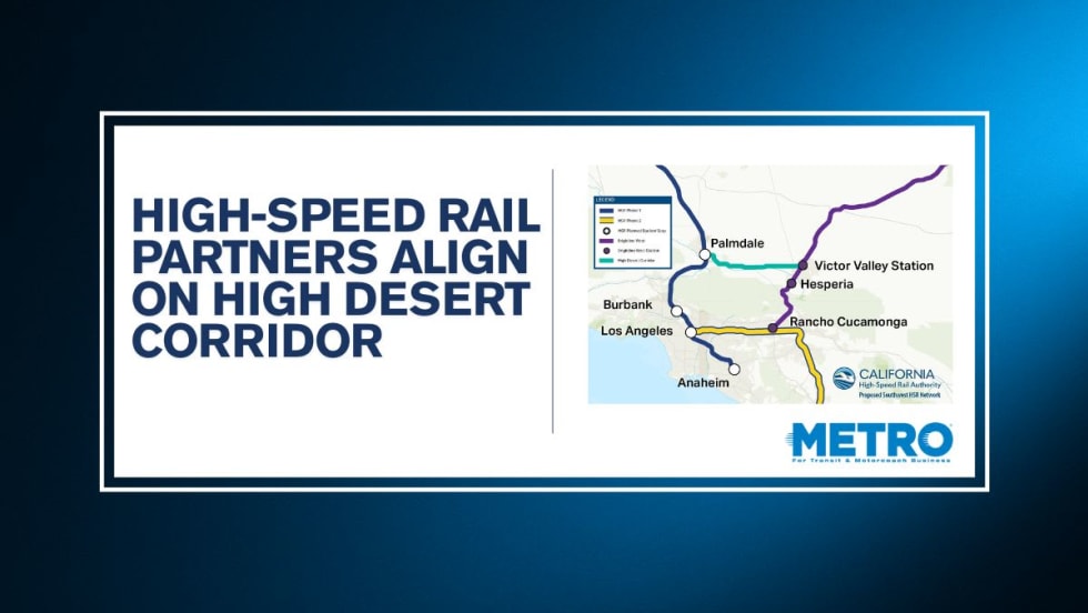
California High-Speed Rail Authority Signs MOU to Advance High Desert Corridor
The agreement deepens collaboration between the California High-Speed Rail Authority and the High Desert Corridor Joint Powers Agency, supporting design integration, cost savings, and faster delivery of a key Southern California rail link.
Read More →
Building the Next Generation of Transit Technology
In this edition of METROspectives, Luminator CEO Magnus Friberg discusses the company's transformation, the growing role of AI and software, and what's next for transit technology.
Read More →
How Data, Strategy, and Community Engagement Are Reshaping Transit
In this edition of METROspectives, strada360 CEO Steve Lassey discusses how transit agencies can better align planning with operations, leverage data to improve decision-making, and build public trust as they prepare for the future of mobility.
Read More →
TTC Launches Camera Pilot to Curb Illegal Passing of Streetcars
During the pilot, the cameras will measure how often illegal streetcar passing occurs and test the technology's reliability for future automated enforcement.
Read More →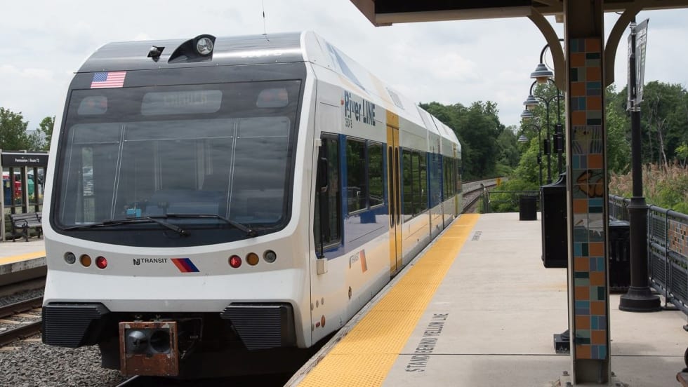
NJ TRANSIT Secures Capital Funding, Adopts FY2027 Budget
The budgets continue investments in infrastructure and equipment to maintain the system in a state of good repair and enhance the overall customer experience.
Read More →
Biz Briefs: Masabi Teams with St. Louis Metro and More
In METRO's latest installment, we take a look at recent news from Transdev, Hitachi, and more partnerships making headlines across the transportation sector.
Read More →