
Sound Transit Adds GoodMaps Wayfinding Tool to 5 Rail Stations
The GoodMaps app, which uses light detection and ranging mapping technology to create highly accurate 3D maps of large public spaces’ interiors, will be added to the Northgate, University of Washington, Capitol Hill, Columbia City, and SeaTac/Airport stations.


GoodMaps includes Spanish language support with additional languages coming in 2025. If the pilot is successful, Sound Transit will evaluate launching GoodMaps to all Link light rail stations.
Photo: WSP
Building on a successful pilot launched earlier this year, Sound Transit is extending the use of the GoodMaps app to five additional 1 Line stations.
The GoodMaps app, which uses light detection and ranging (LiDAR) mapping technology to create highly accurate 3D maps of large public spaces’ interiors, will be added to the Northgate, University of Washington, Capitol Hill, Columbia City, and SeaTac/Airport stations.
The app has been available at the Westlake and International District/Chinatown stations since February 2024.
Benefits of GoodMaps
With its real-time, turn-by-turn directions via a smartphone app, GoodMaps provides accessible wayfinding for all passengers, including those who have visual or hearing impairments, are neurodivergent, or have limited mobility, as well as anyone who feels anxious or uncomfortable in new or complex environments or just wants to find their way more efficiently.
“Expanding GoodMaps will help all of our riders, whether they have vision or mobility challenges, are tourists new to the city or are regular riders experiencing a new part of the system,” said Justin Deno, program manager for passenger-facing technology. “The app aligns with Sound Transit’s commitment to improve passenger experience through technology and provide inclusive and accessible public transportation.”
GoodMaps includes Spanish language support with additional languages coming in 2025. If the pilot is successful, Sound Transit will evaluate launching GoodMaps to all Link light rail stations.
More Technology
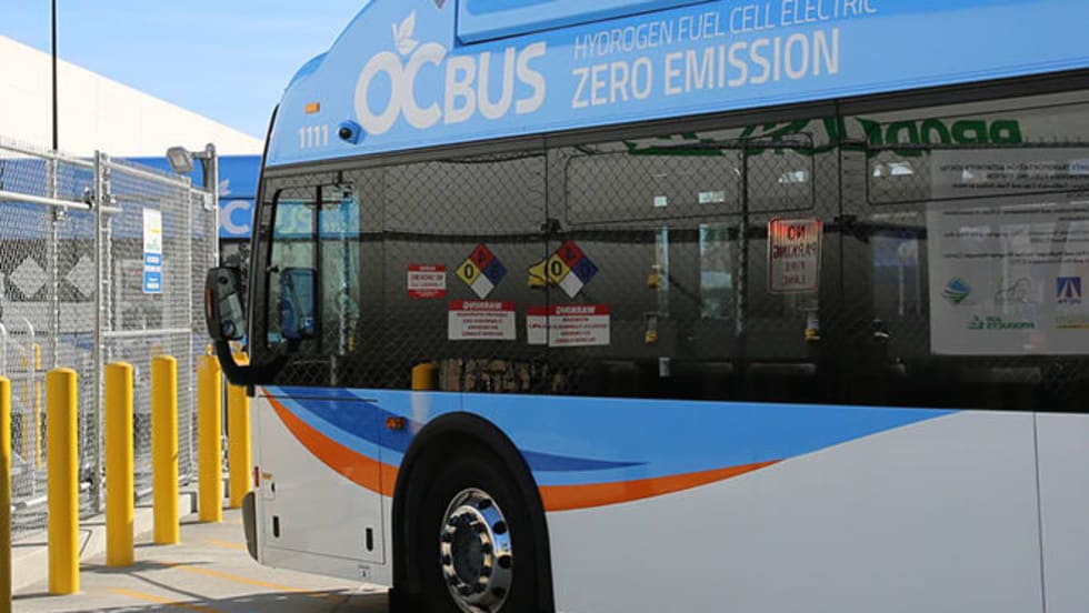
Biz Briefs: OCTA Taps Clean Energy for Hydrogen Station, Stadler to Supply Via Rail Vehicles, and More
From manufacturers and suppliers to transit agencies and motorcoach operators, these updates offer a snapshot of the projects, partnerships and business moves driving the industry forward.
Read More →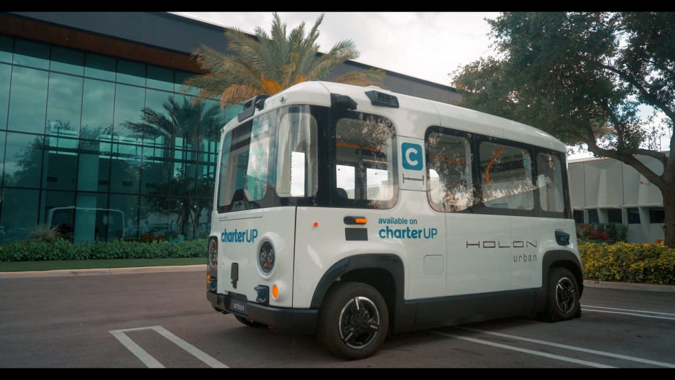
CharterUP Expands Into New Mobility and Autonomous Transportation
Vice President of New Mobility Stephen Joos discusses how CharterUP is leveraging its nationwide transportation network, technology platform, and autonomous vehicle partnerships to expand into workforce mobility, campus shuttles, and transit solutions.
Read More →
METRO Magazine Announces 2026 Innovative Solutions Awards Winners
Projects Recognized for Advancing Mobility Through Technology, Accessibility, Workforce Innovation, and Operational Excellence
Read More →
Cummins Introduces Phased Model Year 2027 Launch Strategy
According to officials, the approach is designed to maintain regulatory compliance, support customer production schedules, and provide additional time to ramp production in a disciplined manner that helps ensure a successful transition for the industry.
Read More →Biz Briefs: STV teams with Amtrak, Motorcoach Operators Boost Fleet and Land Contracts, and More
From manufacturers and suppliers to transit agencies and motorcoach operators, these updates offer a snapshot of the projects, partnerships and business moves driving the industry forward.
Read More →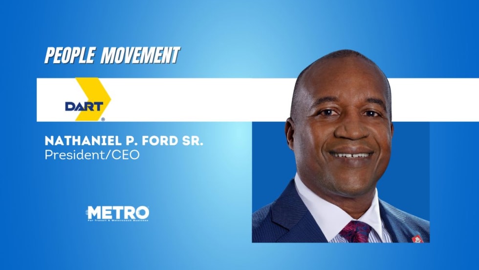
DART Taps Nathaniel P. Ford Sr. as Next President/CEO
Since 2012, Ford has served as the CEO of the Jacksonville Transportation Authority
Read More →
AC Transit’s Cecil Blandon on Building the Next Generation of Transit Maintenance Leaders
The agency’s maintenance chief discusses leadership, workforce development, zero-emission technology, and preparing technicians for the future of public transportation.
Read More →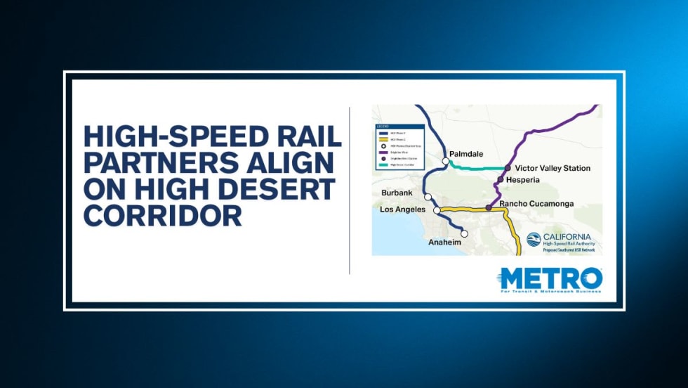
California High-Speed Rail Authority Signs MOU to Advance High Desert Corridor
The agreement deepens collaboration between the California High-Speed Rail Authority and the High Desert Corridor Joint Powers Agency, supporting design integration, cost savings, and faster delivery of a key Southern California rail link.
Read More →
Building the Next Generation of Transit Technology
In this edition of METROspectives, Luminator CEO Magnus Friberg discusses the company's transformation, the growing role of AI and software, and what's next for transit technology.
Read More →
How Data, Strategy, and Community Engagement Are Reshaping Transit
In this edition of METROspectives, strada360 CEO Steve Lassey discusses how transit agencies can better align planning with operations, leverage data to improve decision-making, and build public trust as they prepare for the future of mobility.
Read More →