
BLOGS: Bus bunching, diffusing conflict, congestion charging, etc.
2019's Cities with the Best (and Worst) Public Transportation
Ranks 100 U.S. cities across three key dimensions: Accessibility; Convenience; Safety; Reliability; and Public Transit Resources.
by Adam McCann
January 2, 2020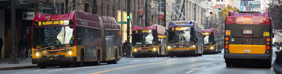
Seattle ranked as the "best" city for public transportation in the U.S. in a new report from WalletHub.
Photo: King County Metro
7 min to read
Public transportation may be a simple convenience or an absolute daily necessity, depending on the city and the size of its population. The scope of public transportation in giant metropolises like New York City can be massive.
According to the MTA, the New York City subway has over 665 mainland track miles and transports over 1.75 billion passengers per year. That’s not to mention the city’s 5,700 buses that carry over 760 million passengers per year.
There are many benefits to using public transportation over personal vehicles. The first is economic growth. According to the American Public Transportation Association, “every $1 invested in public transportation generates $4 in economic returns.” In addition, the APTA states that taking public transportation is cheaper in the long run than buying a vehicle and paying for its upkeep and gas costs. Public transportation also has drastically lower odds of an accident than driving a personal vehicle and helps to cut down pollution from emissions.
But not all cities have the same quality of public transportation. To find out where passengers will fare best during their daily commute, WalletHub compared 100 cities across 17 key metrics. Our data set ranges from share of commuters who use public transit and average age of the fleet to number of injuries and peak hours spent in congestion.
Main Findings
Cities with the Best Public Transportation
Overall Rank (1=Best) | City | Total Score | ‘Accessibility & Convenience’ Rank | ‘Safety & Reliability’ Rank | ‘Public Transit Resources’ Rank |
|---|---|---|---|---|---|
1 | Seattle, WA | 77.97 | 7 | 6 | 3 |
2 | Boston, MA | 77.84 | 2 | 34 | 10 |
3 | San Francisco, CA | 75.21 | 1 | 27 | 80 |
4 | Washington, DC | 71.23 | 3 | 48 | 52 |
5 | Madison, WI | 71.06 | 46 | 1 | 4 |
6 | Jersey City, NJ | 69.05 | 4 | 22 | 97 |
7 | New York, NY | 68.87 | 5 | 22 | 97 |
8 | Reno, NV | 68.13 | 76 | 8 | 1 |
9 | Honolulu, HI | 67.85 | 30 | 13 | 12 |
10 | Portland, OR | 66.82 | 13 | 31 | 29 |
11 | Minneapolis, MN | 66.72 | 8 | 51 | 31 |
12 | Denver, CO | 65.98 | 14 | 25 | 27 |
13 | Oakland, CA | 65.68 | 10 | 27 | 80 |
14 | Los Angeles, CA | 64.79 | 15 | 15 | 60 |
15 | San Jose, CA | 64.47 | 21 | 21 | 35 |
16 | Boise, ID | 64.45 | 82 | 3 | 37 |
17 | Lubbock, TX | 64.33 | 92 | 14 | 5 |
18 | Milwaukee, WI | 64.18 | 42 | 4 | 18 |
19 | San Diego, CA | 64.13 | 32 | 11 | 15 |
20 | Austin, TX | 63.66 | 19 | 68 | 2 |
21 | Baltimore, MD | 63.50 | 12 | 35 | 79 |
22 | Chicago, IL | 63.33 | 6 | 71 | 59 |
23 | Lincoln, NE | 63.10 | 24 | 20 | 46 |
24 | Chula Vista, CA | 62.46 | 89 | 11 | 15 |
25 | Laredo, TX | 61.52 | 99 | 5 | 43 |
26 | Santa Ana, CA | 61.48 | 35 | 15 | 60 |
27 | Long Beach, CA | 61.25 | 38 | 15 | 60 |
28 | Omaha, NE | 60.93 | 69 | 1 | 93 |
29 | Wichita, KS | 60.76 | 66 | 7 | 30 |
30 | Newark, NJ | 60.17 | 16 | 22 | 97 |
31 | Memphis, TN | 60.14 | 58 | 10 | 87 |
32 | St. Paul, MN | 59.00 | 27 | 51 | 31 |
33 | Pittsburgh, PA | 58.96 | 39 | 53 | 33 |
34 | El Paso, TX | 58.51 | 61 | 40 | 45 |
35 | Fremont, CA | 58.29 | 43 | 27 | 80 |
36 | Greensboro, NC | 58.21 | 57 | 43 | 36 |
37 | Cincinnati, OH | 58.17 | 37 | 42 | 40 |
38 | Irvine, CA | 57.88 | 70 | 15 | 60 |
39 | Toledo, OH | 57.77 | 77 | 58 | 7 |
40 | Albuquerque, NM | 57.67 | 11 | 88 | 19 |
41 | San Antonio, TX | 57.63 | 49 | 55 | 6 |
42 | Aurora, CO | 57.60 | 81 | 25 | 27 |
43 | Corpus Christi, TX | 57.43 | 54 | 67 | 8 |
44 | Anaheim, CA | 57.16 | 74 | 15 | 60 |
45 | San Bernardino, CA | 56.94 | 60 | 32 | 49 |
46 | Cleveland, OH | 56.65 | 18 | 73 | 53 |
47 | Atlanta, GA | 56.47 | 22 | 41 | 96 |
48 | Riverside, CA | 56.37 | 65 | 32 | 49 |
49 | Birmingham, AL | 56.15 | 97 | 30 | 44 |
50 | Durham, NC | 56.06 | 36 | 49 | 66 |
51 | Las Vegas, NV | 56.06 | 44 | 37 | 76 |
52 | Miami, FL | 55.86 | 20 | 45 | 94 |
53 | Tucson, AZ | 55.85 | 33 | 57 | 41 |
54 | Detroit, MI | 55.47 | 52 | 47 | 73 |
55 | Phoenix, AZ | 55.39 | 26 | 61 | 67 |
56 | Orlando, FL | 55.07 | 25 | 78 | 38 |
57 | Lexington-Fayette, KY | 54.96 | 63 | 77 | 11 |
58 | Anchorage, AK | 54.88 | 50 | 54 | 42 |
59 | Fort Wayne, IN | 54.85 | 88 | 50 | 55 |
60 | Colorado Springs, CO | 54.66 | 79 | 72 | 9 |
61 | Jacksonville, FL | 54.16 | 62 | 36 | 83 |
62 | Columbus, OH | 54.13 | 45 | 59 | 54 |
63 | Buffalo, NY | 53.91 | 40 | 56 | 75 |
64 | Stockton, CA | 53.82 | 90 | 9 | 84 |
65 | Dallas, TX | 53.78 | 29 | 79 | 20 |
66 | Nashville, TN | 53.73 | 31 | 60 | 85 |
67 | Scottsdale, AZ | 53.32 | 68 | 61 | 67 |
68 | Houston, TX | 53.32 | 34 | 70 | 65 |
69 | North Las Vegas, NV | 52.72 | 94 | 37 | 76 |
70 | Sacramento, CA | 52.09 | 51 | 44 | 90 |
71 | Virginia Beach, VA | 51.99 | 47 | 74 | 56 |
72 | Winston-Salem, NC | 51.63 | 85 | 69 | 14 |
73 | Raleigh, NC | 51.42 | 41 | 89 | 13 |
74 | Norfolk, VA | 51.18 | 48 | 74 | 56 |
75 | Irving, TX | 51.12 | 56 | 79 | 20 |
76 | Glendale, AZ | 50.84 | 98 | 61 | 67 |
77 | Garland, TX | 50.38 | 84 | 79 | 20 |
78 | Hialeah, FL | 50.28 | 83 | 45 | 94 |
79 | Fresno, CA | 50.22 | 71 | 87 | 26 |
80 | Henderson, NV | 50.09 | 95 | 37 | 76 |
81 | Louisville, KY | 49.83 | 64 | 85 | 47 |
82 | Chandler, AZ | 49.55 | 80 | 61 | 67 |
83 | Chesapeake, VA | 49.38 | 93 | 74 | 56 |
84 | Fort Worth, TX | 49.26 | 75 | 79 | 20 |
85 | Plano, TX | 49.13 | 78 | 79 | 20 |
86 | Mesa, AZ | 49.00 | 86 | 61 | 67 |
87 | Bakersfield, CA | 48.98 | 59 | 86 | 74 |
88 | Kansas City, MO | 48.76 | 23 | 93 | 34 |
89 | Philadelphia, PA | 48.73 | 9 | 97 | 86 |
90 | Gilbert, AZ | 48.52 | 100 | 61 | 67 |
91 | St. Louis, MO | 46.51 | 17 | 96 | 51 |
92 | Baton Rouge, LA | 46.26 | 91 | 91 | 17 |
93 | Arlington, TX | 45.70 | 96 | 79 | 20 |
94 | Oklahoma City, OK | 45.64 | 55 | 90 | 89 |
95 | Tulsa, OK | 43.02 | 72 | 94 | 48 |
96 | New Orleans, LA | 42.43 | 28 | 92 | 100 |
97 | Charlotte, NC | 40.67 | 53 | 95 | 88 |
98 | Tampa, FL | 24.69 | 67 | 98 | 91 |
99 | St. Petersburg, FL | 24.03 | 73 | 98 | 91 |
100 | Indianapolis, IN | 21.13 | 87 | 100 | 39 |
Survey Methodology
To determine the cities with the best and worst public transportation systems, WalletHub compared a sample of 100 U.S. cities across three key dimensions: 1) Accessibility & Convenience, 2) Safety & Reliability and 3) Public Transit Resources.
We evaluated those dimensions using 17 relevant metrics, which are listed below with their corresponding weights. Each metric was graded on a 100-point scale, with a score of 100 representing the most favorable living conditions.
Finally, we determined each city’s weighted average across all metrics to calculate its overall score and used the resulting scores to rank-order the cities in our sample. Our sample considers only the city proper in each case and excludes cities in the surrounding metro area.
Accessibility & Convenience – Total Points: 40
Share of Commuters Who Use Public Transit: Double Weight (~6.15 Points)
Average Commute Time for Transit Users: Full Weight (~3.08 Points)
Average Car Commute Time as Share of Average Public Transport Commute Time: Double Weight (~6.15 Points)
Transit Connectivity Index: Full Weight (~3.08 Points) Note: The TCI is a measure of how connected the average household member is to the availability of a transit ride.
Jobs Accessible Within a 30 Minute Transit Commute per 100 Civilian Employed Residents: Full Weight (~3.08 Points)
Peak Hours Spent in Congestion: Full Weight (~3.08 Points) Note: The total number of hours lost in congestion during peak commute periods compared to free-flow periods on a per capita basis. Peak corresponds to the absolute worst portion of the morning and afternoon commute, while free-flow is the best performance experienced over 24 hours.
Annual Public Transport Cost as Share of Median Annual Household Income: Double Weight (~6.15 Points)
Share of Commuters Who Prefer Public Transport: Full Weight (~3.08 Points) Note: This refers to commuters that choose public transportation even if they have one or more vehicles available.
Presence of Dedicated Rapid Bus & Rail Transport: Full Weight (~3.08 Points) Note: This binary metric measures the presence or absence of dedicated rapid bus and rail systems in a city.
Airport Accessibility by Public Transit: Full Weight (~3.08 Points) Note: This binary metric measures the presence or absence of a direct fixed-guideway access to an airport terminal or free bus shuttle access from rail station to an airport terminal.
Safety & Reliability – Total Points: 40
Public Transit Safety and Security Events per Passenger Miles Traveled: Full Weight (~10.00 Points) Note: Events include the following: collision, derailment, fire, security and not otherwise classified events.
Public Transit Injuries per Passenger Miles Traveled: Full Weight (~10.00 Points)
Public Transit Fatalities per Passenger Miles Traveled: Double Weight (~20.00 Points)
Public Transit Resources – Total Points: 20
Public Transport System Total Fixed Guideway Directional Route Miles per Urbanized Area Population: Full Weight (~4.00 Points) Note: The mileage in each direction over which public transportation vehicles travel while in revenue service.
Total Public Transit Vehicles Operated in Annual Maximum Service per Service Area Population: Double Weight (~8.00 Points) Note: The number of revenue vehicles operated to meet the annual maximum service requirement.
Average Age of Public Transit Fleet: Full Weight (~4.00 Points)
Average Lifetime Miles per Active Vehicles: Full Weight (~4.00 Points) Note: The total miles accumulated on all active vehicles since date of manufacture divided by the number of active vehicles.
Article, originally posted Sept.10, 2019, reprinted with permission from WalletHub.com
More Management
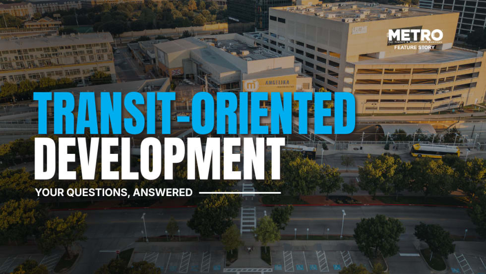
What Transit-Oriented Development Means for the Future of Public Transportation
Once viewed primarily as transit operators, agencies are now leveraging land, partnerships, and long-term planning to boost ridership, expand housing, and strengthen communities.
Read More →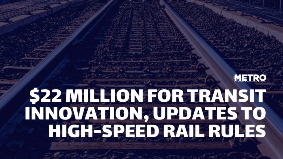
USDOT Announces $22 Million for Transit Innovation, Updates High-Speed Rail Rules
New federal transit funding will support safety, accessibility, and technology projects as updated rail regulations establish new noise standards for high-speed trains.
Read More →
Transportation Construction Coalition Unveils Infrastructure Case Studies Ahead of Federal Funding Deadline
The coalition noted the next surface transportation bill should provide sustained investment in highways and public transit to strengthen freight movement, improve safety, and support economic growth.
Read More →
People Movement: American Bus Association Extends Ferguson and More
METRO’s People Movement highlights the latest leadership changes, promotions, and personnel news across the public transit, motorcoach, and people mobility sectors.
Read More →
METRO Magazine Announces 2026 Innovative Solutions Awards Winners
Projects Recognized for Advancing Mobility Through Technology, Accessibility, Workforce Innovation, and Operational Excellence
Read More →
MBTA Rolls Out Pilot Programs to Cut Costs, Simplify Travel
Three new fare pilots — including unlimited two-hour transfers, reduced express bus fares, and free transit for eligible seniors — will launch this fall as Massachusetts extends popular commuter rail discounts through November.
Read More →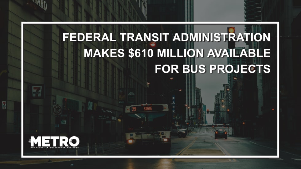
FTA Opens $610 Million Funding Opportunity for Bus Infrastructure Projects
The latest Notice of Funding Opportunity provides transit agencies with funding for bus facilities, fleet modernization, and low- and no-emission vehicles, with applications due September 21.
Read More →Biz Briefs: STV teams with Amtrak, Motorcoach Operators Boost Fleet and Land Contracts, and More
From manufacturers and suppliers to transit agencies and motorcoach operators, these updates offer a snapshot of the projects, partnerships and business moves driving the industry forward.
Read More →
Massachusetts Approves $530M to Strengthen MBTA Operations, Infrastructure
The funding package targets operating stability, capital improvements, and fare affordability, offering a model for agencies navigating long-term funding challenges.
Read More →
LA Metro Marks Banner Year, Sets Ambitious Goals for New Fiscal Year
Incoming LA Metro Board Chair and Los Angeles Mayor Karen Bass joined outgoing Board Chair Fernando Dutra and LA Metro CEO Stephanie Wiggins to review accomplishments from fiscal year 2026, which included the opening of new rail extensions, advancement of major transit projects, expanded safety programs, and new rider amenities.
Read More →